“`html
Flood Risk Increasing in Pacific Northwest
The rising background sea levels expected by the year 2100, combined with the immediate impact of earthquake-driven land subsidence, present a growing hazard to the Pacific Northwest. Communities along this coastal region grapple with potentially delayed responses and prolonged recovery periods from significant seismic events, due to damaged infrastructure. Over time, this threat could make many coastal communities uninhabitable.
Currently, much of the low-lying land in the Pacific Northwest has been modified for agricultural purposes such as cattle grazing and farmland. These areas, safeguarded by diking and draining, face a potential economic downturn as increased tide levels could lead to over-salinization, rendering the soil unusable. Natural systems, including coastal estuaries, intertidal wetlands, and protective dunes and beaches, are susceptible to erosion. Such landscapes act as crucial buffers, dispersing storm surges and wave energy to safeguard against both erosion and property damage. The degradation of these ecosystems might be irreversible, with inland migration hindered by existing geographical features and human development.
Losses in intertidal wetlands significantly undermine ecosystem services that these habitats provide, such as water filtration, supporting fish and shorebird populations, and carbon storage. Intertidal wetlands act as natural carbon sinks, and their destruction or conversion to tidal flats greatly diminishes their carbon sequestration capabilities, exacerbating climate change issues.
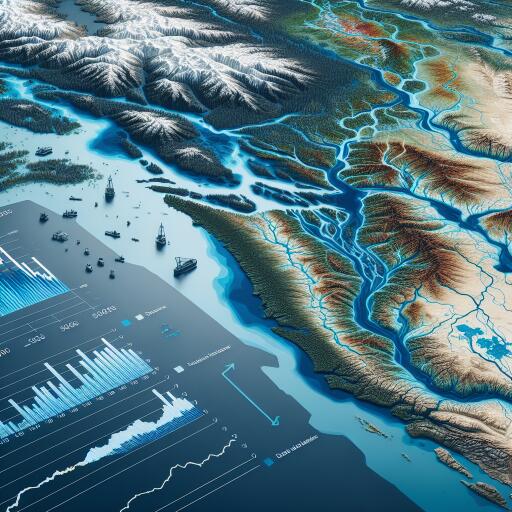
The Cascadia Subduction Zone, part of the Pacific “Ring of Fire,” is a hotspot for some of the world’s strongest seismic activities, including earthquakes and volcanic eruptions. The last recorded great earthquake in this area, those measuring over 8.0 in magnitude, was on January 26, 1700. Coastal geological records of previous earthquakes and the resulting subsidence are vital to comprehend this hazard fully.
Research from studies of the past six to seven thousand years of geologic evidence in the area indicates that the Pacific Northwest has experienced 11 significant earthquakes, occurring every 200 to 800 years. Historically, these earthquakes have caused land levels along the coast to drop between 1.5 to 6.5 feet almost instantly.
“Cascadia is a unique geologic region. It might not be densely populated, but its numerous estuaries all fall within the subsidence zone, emphasizing the larger potential impacts of subsidence here compared to other regions recently affected by large seismic events worldwide.”
Similar subduction zones are found off the shores of various areas including Alaska, Japan, and New Zealand, among others. Typically, one tectonic plate slips beneath another while the upper plate gradually builds pressure over centuries. When this pressure is released, an earthquake occurs. In the ocean, this can lead to uplifting the submerged plate, consequently creating a tsunami. On land, the earthquake can cause the coastline to drop, suddenly sinking the coastline by several feet.
The sequence begins with earthquake shaking—potentially lasting four to six minutes for magnitudes of 9.0 or greater. During this shaking, land subsides, and depending on tides, low-lying areas might flood immediately. About 15 to 20 minutes later, a tsunami follows, bringing more flooding. This entire ordeal unfolds in less than half an hour, with multiple waves potentially continuing over the next one to two hours. However, the effects of land subsidence can last for decades or even centuries.
Historical instances of such changes include the 1960 earthquake in Chile, which submerged pine forests and agricultural lands, converting them into tidal marshes. This event flooded coastal towns, forcing evacuations. Similar effects were seen in the 1964 Alaska earthquake, necessitating the relocation of communities and infrastructure. The 2004 Sumatra-Andaman earthquake ravaged coastal resources, and the 2011 Japan earthquake disrupted ports and infrastructure on a massive scale.
These observations are pertinent far beyond the borders of Cascadia. They inform hazard assessment and preparation strategies for similarly tectonically active regions worldwide.
In conclusion, the impending flood risks in the Pacific Northwest require immediate and comprehensive action to mitigate potential damages. Alongside environmental impacts, these natural hazards pose significant social and economic challenges that necessitate coordinated and informed response strategies.
“`


Leave a Reply