Spatial heterogeneity and driving factors of ecosystem service trade-offs in Beijing’s ecological conservation area: Insights for spatial planning and management – Landscape Ecology
As the capital’s urban footprint continues to expand, Beijing’s ecological conservation area is doing heavy ecological lifting—cooling heat, storing carbon, buffering floods, supporting biodiversity, and providing recreation. Yet these services rarely move in lockstep. New analyses reveal strong spatial heterogeneity and distinct trade-offs across the metropolis’ mountain–plain gradient, offering practical guidance for planners seeking to balance development, resilience, and human well-being.
Why ecosystem service trade-offs matter
Ecosystem services seldom increase all at once. Intensifying food production can reduce habitat quality; urban greening boosts cooling and carbon storage but may lower water yield through higher evapotranspiration; improved recreational access can pressure sensitive areas. Understanding where these services cluster, conflict, or co-benefit is central to designing fair and effective land-use policies and keeping the city’s “ecological safety net” intact.
How the landscape was examined
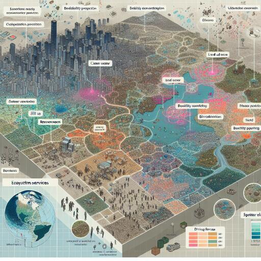
- Multi-source Earth observation and process-based modeling were used to map core services: carbon sequestration, soil retention, water yield and regulation, habitat quality, climate regulation (cooling/evapotranspiration), and recreation potential.
- Urban–rural gradients and topographic belts (mountains, piedmont, plains) structured the analysis to expose spatial heterogeneity.
- Statistical learning and Bayesian belief network approaches disentangled drivers, capturing nonlinearities, thresholds, and conditional probabilities among land use, climate, terrain, and socioeconomic variables.
- Landscape configuration metrics (patch size, connectivity, edge density) linked spatial pattern to service performance and trade-offs.
What stands out across Beijing’s ecological conservation area
- Mountain strongholds in the northwest and west: High carbon storage, soil retention, and habitat quality cluster in forested, steep terrain. These areas underpin citywide flood regulation and biodiversity but can trade off with provisioning services and, in some basins, with downstream water yield during greening surges.
- Piedmont transition belts: The sharpest conflicts emerge here. Agricultural production, expanding settlements, tourism nodes, and transport corridors overlap, generating hotspots where cooling, habitat, and water regulation compete with development pressure.
- Eastern and southern plains: Higher water yield and accessibility, but lower habitat quality and carbon density. Blue–green corridors are fragmented, weakening cooling and stormwater buffering in heat-prone districts.
- Urban cores: Strong demand for recreation and cooling; supply depends on the size and connectivity of green–blue networks. Pocket parks help locally, but continuous corridors deliver outsized climate and biodiversity benefits.
Key trade-offs and synergies
- Carbon–soil synergy: Forest and shrub mosaics generally deliver both, especially on slopes with intact ground cover.
- Greening–water trade-off: In some subcatchments, increased vegetation cover elevates evapotranspiration, potentially lowering water yield—context matters, especially under warming and variable precipitation.
- Recreation–habitat tension: Improved trail access and scenic infrastructure can erode habitat quality without visitor management and zoning.
- Agriculture–biodiversity trade-off: Intensification reduces habitat and regulating services; diversified practices and buffer strips improve multifunctionality.
- Connectivity multiplier: Well-connected green–blue networks amplify cooling, pollination, and dispersal, reducing the risk of localized “service deserts.”
What drives the patterns
- Land-use intensity and configuration: Impervious cover, patch fragmentation, and road density are consistent predictors of trade-off intensity.
- Topography and soils: Elevation, slope, and substrate control erosion risk, water retention, and feasible vegetation structure.
- Climate variability: Precipitation and heat extremes shape water–energy balances, altering relationships among cooling, water yield, and vegetation productivity.
- Policy zoning and governance: Ecological conservation redlines, nature reserves, and urban growth boundaries shift service bundles when enforcement and connectivity align.
- Socioeconomic demand: Population density, tourism flows, and infrastructure access steer recreational pressure and land conversion hotspots.
Implications for spatial planning and management
- Differentiate by gradient: Conserve and connect high-synergy mountain cores; manage transition belts with fine-grained zoning that separates sensitive habitats from intensive uses; retrofit plains with continuous blue–green spines.
- Design with thresholds in mind: Service relationships change nonlinearly. Avoid imperviousness and fragmentation levels that trigger drops in cooling, flood buffering, or habitat quality.
- Build a citywide cooling network: Align ventilation corridors with river valleys and foothill gaps; pair urban forests with reflective surfaces and permeable pavements to cut heat while maintaining water balance.
- Reward upstream stewards: Payment for ecosystem services can compensate mountainous counties for carbon storage, soil retention, and water regulation that benefit downstream districts.
- Make agriculture multifunctional: Diversified rotations, hedgerows, and riparian buffers raise pollination, pest control, and soil health without sacrificing yields.
- Manage recreation smartly: Use trail zoning, seasonal closures, and visitor quotas in biodiversity hotspots; concentrate facilities in robust zones.
- Protect and expand corridors: Prioritize restoration where small investments reconnect habitats and unlock multiple co-benefits.
Tech-forward governance
- Dynamic monitoring: Cloud-based remote sensing pipelines can track service shifts, detect fragmentation, and flag emerging trade-off hotspots in near-real time.
- Scenario planning: Simulate development and restoration pathways to compare outcomes for water, heat, carbon, and biodiversity before decisions are locked in.
- Participatory mapping: Combine social preferences for recreation and cultural benefits with biophysical models to align supply and demand.
- Open indicators: Shared, spatially explicit dashboards build accountability across jurisdictions.
What to watch next
Rapid urban warming and drought variability could intensify water–cooling conflicts, especially in transition belts. At the same time, large-scale restoration and corridor expansion may strengthen carbon–soil–habitat synergies if designs preserve hydrologic function. The most resilient path threads these realities: protect the mountain backbone, reconnect the plains, and steer growth toward a multifunctional mosaic.
Data note
Underlying datasets, model configurations, and indicator layers can be shared upon reasonable request to support replication and local planning applications.


Leave a Reply