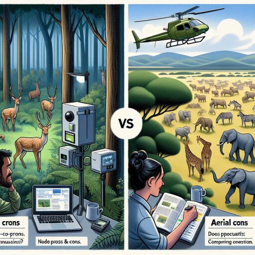
Comparing Camera Traps and Aerial Surveys for Ungulates
Counting large herbivores across sprawling landscapes has long relied on aircraft—quick, expansive, but often imprecise. A new wave of research now puts ground-based cameras in the spotlight, testing whether automated, non-invasive sensors can match or surpass traditional flyovers for estimating ungulate populations. The verdict: camera traps, paired with modern density models, are rapidly reshaping how we see wildlife on the move—and why that matters for conservation.
Why the Method Matters
From prairies to forests, ungulates structure ecosystems through grazing, seed dispersal, and their role as prey. Managing them responsibly requires robust, repeatable numbers. Aerial surveys deliver bird’s-eye counts across vast areas in days, but they face persistent challenges: weather windows, observer fatigue, and imperfect detection from above. Camera traps, by contrast, watch quietly from the ground for weeks or months, creating time-stamped records that reveal not just how many animals pass by—but when, how often, and with whom.
How Camera-Based Density Models Work
Modern camera approaches build on a simple idea: if you know how frequently animals encounter cameras, and you understand how detection varies with distance, time, and behavior, you can estimate how many animals are actually present. Recent studies employed a structured design—strategic placement in high-traffic corridors, consistent settings, and rigorous calibration—to translate image sequences into density estimates. The approach leverages:
- Non-invasive sampling over long periods
- Behavioral context (activity peaks, group sizes, social structure)
- Statistical models that account for detection probability and movement
The payoff is not just a headcount. Cameras capture seasonality, migration timing, and habitat preferences—insights that can guide where to focus restoration or conflict mitigation.
Aerial Surveys: Speed with Trade-offs
Helicopter and fixed-wing counts remain a cornerstone of wildlife monitoring, especially for remote or rugged regions. Their strengths are clear: rapid coverage, standardized transects, and experienced observers. Yet observers can miss animals concealed by canopy, topography, or coloration. Weather constraints, flight safety, and costs limit repeatability. And aerial snapshots, by definition, compress behavior into a single moment—useful for immediate estimates, but thin on temporal nuance.
What Comparative Field Tests Are Showing
Side-by-side trials across mixed habitats found that well-designed camera networks can deliver density estimates on par with aerial surveys. In areas with dense vegetation or complex terrain, cameras often outperformed aircraft by catching animals that would otherwise disappear into cover. Extended deployment times smoothed out daily and weekly variability, improving precision.
Some key takeaways emerging from these comparisons:
- Detection bias differs: aerial counts risk underestimating in cover; cameras may undercount species that avoid trails or move at camera blind spots.
- Cost dynamics split: aerials concentrate expense into flights; cameras shift costs to upfront hardware and data processing but enable long-term monitoring.
- Behavioral data matters: camera sequences reveal group composition, movement rhythms, and habitat use—valuable for managing hunting quotas, road planning, and grazing impacts.
- Calibration is crucial: both methods benefit from validation (e.g., ground checks for aerials; distance calibration and deployment design for cameras).
Where Each Method Shines
- Use aerial surveys when covering vast, open landscapes quickly; when budgets can support chartered flights; and where canopy is sparse.
- Use cameras where vegetation or terrain undermines aerial visibility; when behavioral data is needed; or when repeated, season-long monitoring is essential.
- Combine both methods to cross-validate estimates, reduce bias, and create a fuller picture of population dynamics.
Design Choices That Change Outcomes
Camera-based density estimates depend on design discipline. Studies that performed best tended to:
- Deploy cameras at standardized heights and angles, avoiding baiting that distorts natural movement
- Place units along natural travel routes while sampling across habitat types to avoid over-representing easy paths
- Record metadata consistently (time, temperature, moon phase) to improve model performance
- Run deployments long enough to capture variability (storms, migration pulses, breeding seasons)
- Use quality control for species ID—AI tools help, but human oversight remains essential
The Technology Edge
Artificial intelligence is transforming camera workflows. Species recognition, individual re-identification (for uniquely marked animals), and automated filtering of false triggers can shrink analysis time from months to days. Paired with spatial models, these tools reduce error and flag anomalies—like sudden shifts in herd composition or unexpected nocturnal activity—that may signal disease, disturbance, or poaching risk.
Implications for Policy and Practice
For wildlife agencies and land stewards, the message is pragmatic: camera networks, thoughtfully deployed and analytically robust, can be a cost-effective complement—or alternative—to flights. They are especially powerful where long-term behavioral insights inform management: setting harvest quotas, protecting migratory corridors, or measuring the impact of fencing, recreation, or drought.
Moreover, transparent protocols enable continuity. As staff change and budgets fluctuate, repeatable camera methods help maintain consistent trend data—a crucial asset in adaptive management and environmental assessment.
Practical Recommendations
- Blend methods when possible: use aerials for broad coverage and cameras for fine-scale, behavioral detail.
- Pilot first: test detection rates in representative habitats before scaling up.
- Invest in data pipelines: curate storage, labeling, and model documentation to ensure reproducibility.
- Plan for ethics and privacy: minimize disturbance, avoid sensitive human imagery, and follow local regulations.
- Budget beyond hardware: allocate time and resources for model calibration, validation, and periodic re-training of AI classifiers.
The Bottom Line
Ground sensors and aircraft are not rivals so much as complementary lenses. Camera traps capture the cadence of life at eye level; aerial surveys deliver reach and speed. Together—and especially when linked with modern analytical models—they unlock clearer, more actionable pictures of ungulate populations. As monitoring shifts from occasional snapshots to continuous, data-rich streams, conservation decisions can be faster, fairer, and better tuned to the rhythms of the landscapes we share.


Leave a Reply