Unraveling Landslide Risks in Darjeeling’s River Basin
Where the foothills meet the high ridges of the Darjeeling Himalayas, the Lish–Gish–Chel River basin mirrors a paradox: stunning mountain scenery shaped by forces that also threaten it. Landslides are a persistent hazard here, disrupting lives, infrastructure, and ecosystems. Untangling why they happen—and how to reduce the danger—requires looking at geology, water, climate, and human choices together.
A Landscape Primed for Instability
The basin is a textbook example of terrain that reacts quickly to stress. Slopes are steep, rock layers are fractured and weathered, and soils vary sharply over short distances. Add seasonal downpours to those ingredients and gravity does the rest. The combination of fragile slopes and intense rainfall elevates the chance that hillsides will fail, particularly where vegetation has been thinned or cut.
What Pushes Slopes Over the Edge
Landslides rarely have a single cause. In this basin, several factors interact:
- Topography: Steeper gradients amplify gravitational pull and reduce the margin of safety for soils and rock.
- Geology and soils: Sheared or highly weathered formations and clay-rich layers can act as slip planes once saturated.
- Hydrology: Dense drainage networks and perched water tables accelerate soil wetting and raise pore pressure.
- Land use: Slope cutting for roads, unplanned construction, deforestation, and poorly managed terracing undermine root reinforcement and disturb natural drainage.
When Rainfall Becomes a Trigger
The monsoon and out-of-season cloudbursts are central to the story. Prolonged or intense rainfall saturates soils, building pore water pressure that reduces the friction keeping grains locked together. The result is a rapid drop in slope stability. Two patterns matter most:
- Intensity bursts: Short, heavy storms can topple marginal slopes in hours.
- Antecedent wetness: Weeks of moderate rain pre-load the landscape, so smaller storms can still trigger failures.
Monitoring these patterns—and understanding how they couple with local geology—improves the accuracy of landslide forecasts.
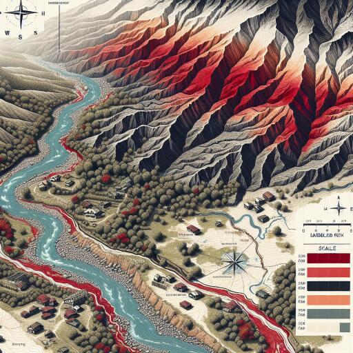
Mapping Risk with Modern Tools
Geospatial technology is transforming how mountainous hazards are assessed. High-resolution satellite imagery, aerial surveys, and field mapping feed into GIS-based models that integrate slope angle, curvature, lithology, soil type, land cover, drainage density, and rainfall metrics. Statistical and machine-learning approaches then estimate where failures are most likely and classify hazard levels from low to very high.
These susceptibility maps are not just academic. They guide decisions such as where to route roads, where to restrict construction, how to prioritize slope stabilization, and which communities need early alerts and evacuation plans. Evaluating at sub-basin or micro-watershed scales is crucial, because the drivers of failure can shift dramatically within a few kilometers.
Human Footprints on Fragile Slopes
Economic activity intensifies hazards if the land is pushed beyond its ecological limits. Key pressure points include:
- Forest loss: Reduced root strength and canopy interception increase runoff and erosion.
- Road cuts and quarrying: Undercutting toes of slopes and leaving unprotected cuts invites failure.
- Hillside construction: Buildings without proper foundations, retaining walls, or drainage concentrate water and add weight.
- Agricultural expansion: Terraces lacking proper drainage or reinforcement can destabilize during heavy rain.
Balanced development—prioritizing slope-compatible designs and ecosystem restoration—can sharply reduce risk while maintaining livelihoods.
From Warnings to Action
Early warning systems are the bridge between scientific insight and safety on the ground. Effective approaches combine:
- Rainfall thresholds: Real-time tracking of intensity and cumulative totals keyed to local trigger levels.
- Low-cost sensors: Soil moisture, pore pressure, and ground movement devices linked via cellular or radio networks.
- Remote sensing: Satellite and drone data to spot new cracks, fresh scarps, and evolving drainage paths.
- Community protocols: Clear alert levels, evacuation routes, and drills co-designed with residents.
Alerts must be timely, understandable, and actionable. Even simple, robust systems—paired with trusted local communication—save lives.
Climate Change Ups the Stakes
Warming trends are shifting rainfall toward more intense, erratic events, increasing flash saturation and runoff. This means risk maps and thresholds need regular updates, and infrastructure must be designed with heavier future loads in mind. Continuous monitoring and adaptive planning are no longer optional; they’re central to resilience.
Priority Actions for the Lish–Gish–Chel Basin
- Establish and maintain basin-wide landslide inventories to validate and refine susceptibility models.
- Adopt zoning that restricts high-risk construction and enforces slope-friendly building codes and drainage standards.
- Revegetate unstable slopes with deep-rooted native species and restore riparian buffers to slow runoff.
- Stabilize critical road sections with engineered retaining structures, bioengineering, and proper culverts.
- Deploy a tiered early warning system integrating rainfall data, in-situ sensors, and community alerts.
- Offer training and resources for household-level measures: contour drains, safe greywater disposal, and maintenance of retaining walls.
- Integrate climate projections into all new infrastructure and hazard plans.
Living With, Not Against, the Mountain
Landslides cannot be eliminated, but their impacts can be managed. In the Darjeeling Himalayas’ Lish–Gish–Chel basin, aligning land use with the landscape’s limits, embracing data-driven planning, and empowering communities can turn a chronic hazard into a manageable risk. The path forward blends ecology, engineering, and local knowledge—protecting both the mountains and the people who call them home.


Leave a Reply