Senegal Turns To AI-Powered Carbon Mapping To Protect Shrinking Forests And Guide Climate Action – iAfrica.com
From the salt-soaked mangroves of the delta to the lush tropical stands in the south and the baobab-dotted savannas up north, Senegal’s forests are shrinking—and fast. Officials estimate roughly 40,000 hectares disappear every year due to wildfires, illegal logging, and land conversion. As tree cover recedes, so does the country’s capacity to lock away carbon, eroding a vital buffer against global warming. Since 2007, the carbon stored in these ecosystems has steadily declined, underscoring the urgency to modernize how the nation measures, manages, and restores its forests.
Rangers On The Front Lines, With Smartphones And Shovels
The Direction des Eaux et Forêts, Chasses et de la Conservation des Sols (DEFCCS) coordinates protection and restoration across regions like Kolda, where Lieutenant Mamadou Diop and colleagues blend traditional stewardship with digital tools. Their daily work spans reforesting burned areas around villages such as Yassin Madina, organizing community firebreaks, and guiding sustainable harvesting for fuelwood and agroforestry. To anticipate trouble, Diop turns to remote sensing apps on his phone and computer, scanning for wildfire-prone patches and other hotspots that could derail local livelihoods.
Yet a critical bottleneck remains: the country’s carbon maps are outdated and expensive to update. To estimate biomass, rangers venture deep into the bush by motorbike, logging tree height, trunk diameter, canopy cover, and species across sample plots. This boots-on-the-ground method is essential, but it is slow, costly, and difficult to scale to national coverage.
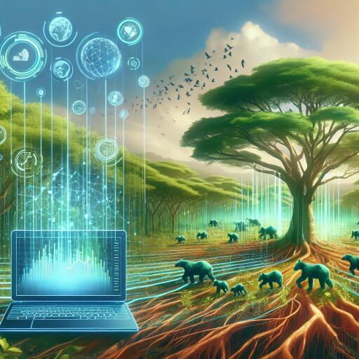
AI Steps In: Automating Biomass Estimates For Faster Decisions
Enter Carbon Lense Senegal, a new initiative designed to bring state-of-the-art automation to carbon accounting. Implemented by GIZ with support from the BMZ-funded Initiatives Data Economy and FAIR Forward, and in partnership with data354 and the Ministry of Environment and Ecological Transition, the project scales an AI-powered High Carbon Stock Approach previously piloted in Indonesia, India, and Ivory Coast.
The core idea is straightforward: merge open satellite imagery with locally collected forest inventory data and train models to estimate biomass and, by extension, carbon storage. With the right calibration, these algorithms can generate near-automatic carbon maps, updated far faster than traditional surveys. The twist in West Africa is the region’s biodiversity—many local species still lack robust scientific parameters for conversion from tree measurements to biomass. To close that gap, the project collaborates with the University of Ziguinchor to strengthen the underlying science so the models reflect Senegal’s unique species mix.
“An automated carbon map would greatly simplify our forest management work,” said Lt. Diop. “Right now, we can travel up to 300 kilometers a week just to collect the data we need.”
Fieldwork That Trains The Algorithms
To anchor the AI in real-world conditions, a joint field campaign tested the DEFCCS inventory protocol in the Boudié forest near Yassine Mandina, in the Sédhiou region. Rangers, university researchers, and project staff measured plots, recorded species, and captured biomass data necessary to calibrate the models. The Middle Casamance landscape—scarred by burn marks and frequented by illegal logging—offered a rigorous proving ground for the protocol.
“The forests are changing, but we rely on them for agroforestry,” said Babacar Mané, community chief of Yassin Madina. “Forest fires add another layer of difficulty.”
These local insights shape how risk is mapped, how reforestation is prioritized, and how fire management can be strengthened. By pairing field expertise with machine learning, the project aims to reduce uncertainties in biomass estimates and deliver credible numbers for planners and communities alike.
Why It Matters: From Village Firebreaks To National Climate Goals
Beyond day-to-day management, automated carbon mapping carries national implications. Senegal’s climate pledges under the Paris Agreement rely on accurate, transparent reporting of emissions and removals. Up-to-date biomass maps help quantify the country’s carbon sink and track progress from interventions such as mangrove restoration, assisted natural regeneration, or community-led woodlots.
The initiative, showcased at the UNFCCC Technology Executive Committee’s AI for Climate Action Forum 2025 in Tanzania, illustrates how collaboration between digital innovators, forestry agencies, and local communities can accelerate climate action. By translating satellite pixels into credible carbon numbers, the approach supports both biodiversity protection and the country’s development priorities.
What Comes Next
Carbon Lense Senegal will extend field campaigns across more ecological zones, with the objective of delivering a national biomass map. The roadmap keeps communities at the center: rangers provide ecological expertise and oversee data collection; local leaders guide site priorities and ensure interventions respect customary use; and researchers refine species-specific equations that improve model accuracy.
If successful, Senegal could refresh its forest carbon data at a cadence measured in months rather than years—vital in a warming climate where conditions on the ground can shift rapidly. The payoff extends beyond climate reports, offering actionable intelligence for fire prevention, habitat conservation, and agroforestry planning.
Expected benefits
- Faster, more consistent updates to forest carbon and biomass maps
- Better targeting of reforestation and fire management where risks are highest
- Improved transparency for national climate reporting and policy design
- Stronger alignment between AI outputs and on-the-ground realities through community participation
Senegal’s forests may be under pressure, but the combination of science, local knowledge, and machine learning is opening a more responsive path forward—one where rangers spend less time on motorbikes collecting data and more time restoring the green shields that protect communities and the climate.


Leave a Reply