UAVs Illuminate Forest Succession: RGB vs. Multispectral
Forest scientists are turning to the sky to track how woodlands recover, reorganize, and mature after disturbance. A recent investigation in seasonal tropical forests shows how Unmanned Aerial Vehicles (UAVs) can map successional stages with precision, while directly comparing what standard RGB cameras and multispectral sensors each bring to the field.
Why succession is the metric that matters
Forest succession is the long game of ecology: a stepwise shift in species mix, canopy architecture, and ecosystem function following events like logging, fire, or storms. Reading those shifts accurately helps answer urgent questions—how much carbon can a recovering stand store, which patches need restoration, and where biodiversity is gaining or losing ground. In highly diverse tropical systems, where multiple species share tight spaces, traditional methods struggle to keep pace with the fine-grained changes unfolding over months and years.
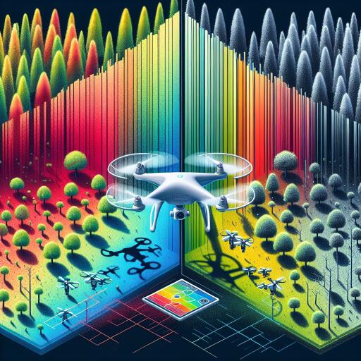
Two views from above: RGB and multispectral
UAVs typically carry one of two imaging payloads. RGB cameras capture the visible spectrum—red, green, and blue—producing high-resolution, true-color mosaics that excel at delineating canopy boundaries, gaps, and gross structural patterns. Multispectral sensors extend beyond the visible into targeted bands such as near-infrared and red-edge, unlocking vegetation metrics sensitive to leaf chemistry and physiology. Indices like NDVI and red-edge–based variants translate those reflectance patterns into proxies for vigor, stress, and species differences that the human eye—and standard RGB—often miss.
Speed, repeatability, and access
Compared with ground surveys and even many satellite products, drones offer a powerful blend of speed and flexibility. They can be launched on short notice, revisit the same transects frequently, and fly below clouds that foil satellites. That agility opens a window into ephemeral events—leaf flushes, flowering bursts, brief water stress—that shape successional trajectories but are easy to overlook. Just as important, UAVs can survey rugged, dense, or remote terrain where field teams face safety risks and logistical hurdles.
What the side-by-side comparison reveals
The study mapped forest patches representing multiple successional stages and stacked RGB and multispectral outputs for a direct comparison. Key takeaways include:
- RGB imagery provides an accurate, cost-effective overview—great for detecting canopy gaps, estimating crown size variability, and producing 3D surface models through photogrammetry that hint at structural complexity associated with successional age.
- Multispectral imagery adds a diagnostic layer—highlighting physiological differences among plant groups, detecting stress before it is visible, and improving separation of early versus late-successional assemblages where color and texture alone are ambiguous.
- Combining both improves classification—fusing RGB texture and structure with multispectral indices boosts accuracy in mapping successional stages and reducing confusion between similar-looking canopy types.
Time is the secret ingredient
Succession is dynamic, so repeated flights matter as much as spatial detail. Multitemporal UAV campaigns can capture phenological rhythms—seasonal green-up, leaf fall, or flowering—that distinguish species and functional groups. When time-series spectra are coupled with changes in canopy height models, researchers gain a sharper picture of how stands transition from pioneer dominance to more complex, shade-tolerant communities.
From pixels to policy
The practical ramifications are substantial. High-resolution maps of successional stages can guide restoration teams to prioritize areas with stalled recovery, track the success of enrichment plantings, and verify compliance in conservation agreements. For climate strategies, differentiating young regrowth from mature forest refines carbon accounting and helps target protection where it delivers the biggest climate and biodiversity dividends.
Automation is accelerating
Advances in image processing are turning UAV datasets into near-real-time intelligence. Machine learning models—trained on labeled canopy samples—can classify successional stages, flag disturbance, and estimate indicators like leaf area and fractional cover. Object-based image analysis further segments the mosaic into ecologically meaningful units, while data fusion techniques incorporate topography and microclimate layers to enhance predictions. As models generalize, the promise is faster, cheaper monitoring across larger landscapes with fewer field inputs.
Caveats and good practice
Not all forests or questions require the same sensor. RGB cameras are affordable, widely available, and sufficient for many structural metrics. Multispectral payloads cost more and demand careful calibration (including radiometric targets and consistent flight parameters) to ensure temporal comparisons are valid. Thoughtful sampling design—covering representative successional stages, seasons, and illumination conditions—remains essential. And even the best models benefit from ground truthing, whether through rapid botanical plots, canopy spectroscopy, or targeted tree identification.
A sharper lens on recovery
The UAV comparison underscores a simple principle: more spectral information improves ecological interpretation, especially in species-rich tropical settings. Where budgets are tight, RGB still delivers robust structural insights; where the goal is to separate functional types, detect stress early, or refine successional mapping, multispectral data offer clear gains. Pairing the two—with periodic time-series acquisitions—provides a balanced, scalable approach to monitor forest recovery as it happens.
As climate pressures intensify and restoration ambitions expand, this fusion of low-altitude robotics and spectral analytics offers a practical blueprint: fast, repeatable, and fine-grained monitoring that moves beyond static maps. The canopy is telling the story of succession. UAVs—especially when equipped with the right sensors—are finally letting us hear it in detail.


Leave a Reply