Debate sparked by proposal to rewild 9,500-acre Northumberland estate
A sweeping plan to restore nature across a 9,500-acre stretch of uplands in Northumberland has ignited a lively public debate, pitting visions of large-scale ecological recovery against concerns about livelihoods, local wildlife, and who gets to decide the future of a storied landscape.
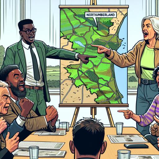
Conservation groups aim to acquire and manage much of the Rothbury Estate — around 15 square miles of former grouse moor, woodland, farmland, streams, and rivers — as a hub for peatland repair, river restoration, and nature-friendly agriculture. Supporters see an opportunity to knit together a 40-mile belt of wild and semi-natural habitats from the coast inland toward Kielder and the Scottish border, potentially creating one of England’s most ambitious nature recovery corridors.
What is being proposed
The initiative focuses on rewetting degraded peat, expanding native woodland, improving water quality, and trialling regenerative farming approaches. Advocates argue this could lock away carbon, hold back floodwaters, reduce wildfire risk, and reverse long-term declines in biodiversity. They also envision improved public access and education, framing the estate as a living laboratory for climate resilience and rural innovation.
Backers say public donations have already contributed more than £10 million toward a £30 million target by early 2026 — a signal, they argue, of strong appetite for nature recovery at landscape scale.
Why it matters
This is one of the largest land opportunities to emerge in England in decades. The estate sits at a geographic and ecological crossroads, where upland blanket bogs feed headwater streams and where moorland, pasture, and forestry shape both wildlife and rural economies. Decisions here will reverberate well beyond one valley, informing how the UK balances food, flood safety, carbon, and countryside culture.
Support and skepticism
While the vision has drawn high-profile endorsements from conservation voices, it has also triggered pushback. A recent critical video from a countryside-focused channel questioned whether the land needs “saving,” asserting that existing management already supports a rich community of species. Some fear that poorly planned rewilding — particularly any predator reintroductions — could harm ground-nesting birds and unravel hard-won gains in certain habitats.
Rural commentators have urged a “bottom-up” approach that starts with plants, invertebrates, soils, and hydrology — not headline species — and demanded transparent baseline data before major changes roll out. They have also raised questions about the long-term funding model and governance, stressing that tenant farmers and local communities must have a central voice.
How the project team says it will proceed
The conservation partnership says it has already acquired part of the estate, including the Simonside Hills, and is undertaking extensive surveys to guide management. According to the plan, every major habitat and species group will be assessed, alongside archaeology and geology, building a long-term data bank to steer decisions. The team also points to collaboration with academic researchers to apply advanced techniques — from remote sensing and LiDAR to eDNA sampling and high-resolution hydrological monitoring — to track change and refine interventions.
Community involvement is described as a core pillar: the project proposes citizen science to collect data, regular engagement with residents and tenants, and the development of a long-term strategy that keeps farming and nature recovery intertwined. The stated intent is to measure outcomes over years, adjust methods based on evidence, and demonstrate how rural businesses, heritage, and habitats can co-exist.
Ecology meets technology
Beyond the headlines, the real test will be in the metrics. Peat depth and moisture, breeding success of waders, water clarity after heavy rain, vegetation structure across moors and pastures, and net greenhouse gas balance are all quantifiable — and increasingly measurable with modern tools. Drones and satellite imagery can track heather and sphagnum shifts; autonomous sensors can log stream chemistry in real time; and machine learning can help detect habitat changes early, cutting costs and guesswork.
If shared openly, such data could defuse some tensions by showing what is actually happening on the ground, rather than relying on assumptions. It could also help farmers tap into emerging environmental markets by evidencing outcomes, whether that is flood mitigation, pollinator benefits, or verified carbon gains from restored bogs.
The bigger picture
Across the UK, landscape-scale restoration is moving from concept to practice. With that shift comes friction: questions about food security, field sports, wildfire risk, public access, and rural identity. The Rothbury plan sits at this fault line. Proponents argue the climate and biodiversity crises demand transformative action; critics worry about unintended ecological consequences and the erosion of local decision-making.
The path forward likely hinges on three things: genuinely shared governance with people who live and work on the land; transparent, independent monitoring; and flexible management that changes course when the evidence demands it. If those conditions are met, Northumberland could become a model for how to repair ecosystems while sustaining vibrant rural economies. If not, it risks becoming another polarised battleground.
For now, the debate is doing something useful: forcing clarity on goals, methods, and trade-offs. In that sense, the future of this landscape won’t be decided by slogans about rewilding or business-as-usual, but by whether the project can prove — with data, dialogue, and delivery — that people and nature can both come out ahead.


Leave a Reply