Understanding the efficacy and efficiency of thermal infrared UAV for wildlife monitoring – Environmental Monitoring and Assessment
Thermal infrared (TIR) sensors mounted on uncrewed aerial vehicles (UAVs) have rapidly become a cornerstone of modern wildlife monitoring. By detecting heat signatures rather than relying on color or shape, these systems reveal animals that are hidden in vegetation, active at night, or too distant for ground surveys. But how effective are they at finding and counting wildlife, and how efficiently can they be deployed across diverse habitats? This article distills current practice into a clear, field-ready perspective, balancing promise with limitations.
How TIR-UAV surveys work
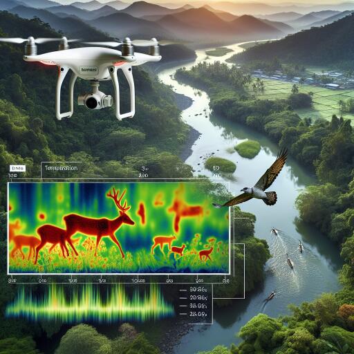
TIR cameras capture long-wave infrared radiation, typically in the 8–14 µm band, translating subtle temperature differences into imagery. When animals are warmer than their surroundings—most reliably at dawn and dusk—TIR signatures stand out. Survey efficacy hinges on flight height (which governs pixel size), frame rate, lens field-of-view, ambient conditions, and how thermal contrast shifts through the day. Many teams pair TIR with RGB imagery or 3D mapping to improve identification and reduce double counting.
Efficacy: detecting what’s there
Efficacy is about accuracy and consistency—detecting the right animals, at the right time, in the right places. TIR-UAVs often outperform traditional ground counts for open-country species and colonial nesters, and they can match or exceed other aerial methods for large mammals. However, performance varies with context:
- Habitat structure: Dense canopy or rugged terrain can occlude heat signatures. Gap detection (flying lower, oblique angles, or multi-pass surveys) helps.
- Thermal background: Sun-warmed rocks, bare soil, and human structures can mimic animals. Early morning windows and cloud cover usually reduce clutter.
- Animal size and behavior: Small-bodied or sedentary species can blend into background noise. Motion-based detection and temporal differencing can improve confidence.
- Modeling imperfect detection: Occupancy and N-mixture frameworks are increasingly used to quantify detection probability and adjust abundance estimates.
Automated analysis is now routine. Convolutional networks and transformer-based models trained on aerial thermal data can detect and classify multiple species, even at varied altitudes. Still, model transfer across regions and seasons is nontrivial; performance can drop when vegetation, background temperature, or target species change. Domain adaptation, curated training sets, and rigorous validation against ground truth are essential.
Efficiency: doing more with less
Compared with manned aircraft, small UAVs lower operational risk, fuel use, and cost. They also offer modular payloads and flexible deployment windows. Efficiency gains are most pronounced when surveys are:
- Well designed: Stratified sampling, optimized transect spacing, and flight plans that minimize turn time (e.g., rosette or lawnmower patterns) reduce air time.
- Automated: Onboard or edge AI provides live detections and reduces post-processing, enabling adaptive flight paths or targeted revisits.
- Scalable: Standardized protocols, consistent metadata, and reproducible QC workflows allow teams to scale from a single site to landscapes.
Battery life, payload weight, and weather windows remain the primary operational constraints. Efficient teams mitigate these with hot-swappable batteries, multi-UAV rotations, and preplanned contingency routes.
Best practices for robust results
- Pick the thermal window: Fly in periods of maximal contrast—often just before sunrise or after sunset—and avoid sun-heated backgrounds when possible.
- Tune altitude to target size: Ensure ground sampling distance is adequate for the smallest target you intend to detect.
- Report detection uncertainty: Use repeat passes, double-observer protocols, or ground truth to estimate detection probability and false positives.
- Fuse sensors: Combine TIR with RGB or 3D products to disambiguate species, verify counts, and improve geolocation accuracy.
- Standardize metadata: Document sensor specs, flight heights, weather, time-of-day, and processing steps to support reproducibility.
- Validate AI models: Use independent test sets, report precision/recall, and stress-test models across habitats and seasons.
Where TIR-UAV excels—and where it struggles
High-confidence applications include open landscapes (ungulates, large birds), colonial roosts (bats, seabirds), and nest detection on grasslands or beaches. Mixed-success scenarios include forest canopies and rocky terrain where thermal clutter and occlusion complicate detection. Small mammals or cryptic species can be detectable, but often require lower flight heights, higher-resolution sensors, or multi-sensor fusion.
Designing surveys that count
Study design remains the linchpin of credible inference. Prior power analyses help determine how many flights, transects, or repeat visits are needed to detect trends or differences among sites. Spatially explicit designs that incorporate habitat covariates increase precision and reveal distribution patterns rather than just totals. Critically, report uncertainty with abundance or occupancy estimates, not just raw counts.
Data stewardship, ethics, and biosafety
- Minimize disturbance: Fly at altitudes that reduce behavioral responses; avoid sensitive breeding windows unless justified.
- Safeguard locations: Generalize or obfuscate coordinates of threatened species to deter exploitation.
- Respect permissions: Secure airspace approvals and local permissions; engage communities early in planning.
- Plan for animal welfare: Monitor for stress responses; abort or adjust if disturbance is observed.
What’s next
Several innovations are improving both efficacy and efficiency: lighter, higher-resolution TIR sensors; real-time, on-drone inference; image fusion and 3D thermal mapping; multi-UAV coordination; and synthetic data to bolster training sets. At the same time, standardized reporting and open, well-annotated datasets are helping benchmark methods and close performance gaps across biomes.
Bottom line
TIR-equipped UAVs have matured from niche tools into scalable survey platforms that can yield more accurate counts, safer operations, and richer ecological insights than many legacy methods. They are not a shortcut past careful experimental design: detection remains imperfect, biases exist, and local conditions matter. When paired with rigorous protocols and transparent reporting, however, TIR-UAV monitoring offers a powerful, cost-effective path to understanding wildlife populations in a warming, rapidly changing world.


Leave a Reply