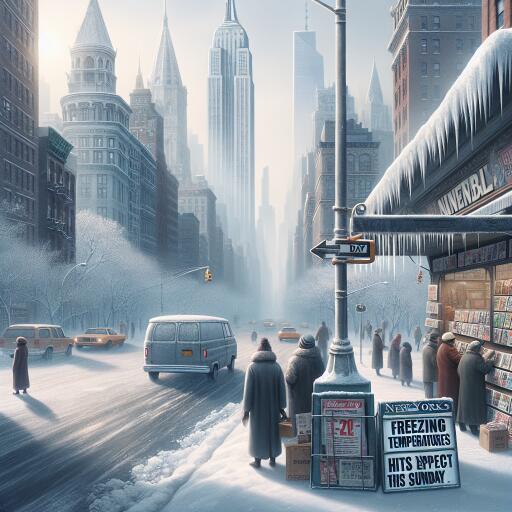
Freezing Temperatures Hit New York City: What to Expect This Sunday | Weekly Voice
New York City is waking up to a sharp plunge in temperatures this Sunday, with the mercury near -12°C (about 9°F). A light northerly wind around 6 mph will make it feel even colder at times, while humidity near 60% adds a damp bite to the air. Atmospheric pressure is rising toward 1018 mb, a sign of clearing skies—good news for visibility, which is generally clear across the five boroughs. The cold, however, will remain the dominant story through the day.
How cold will it feel?
Even a gentle breeze can deepen the chill at these temperatures. Expect a “feels-like” reading in the low single digits during the morning, with only slight moderation in the afternoon. Sunshine may break through as pressure continues to build, but don’t expect the sun to offer much relief—temperatures will likely remain well below freezing for much of the day.
What this means for city life
- Transit: Cold-sensitive rail components and icing on platforms can slow service. Allow extra time and watch for service advisories.
- Roads and sidewalks: Black ice is a risk, especially on shaded blocks, bridges, and overpasses. Sidewalk puddles from yesterday’s melt can refreeze into slick patches.
- Heating demand: Energy use typically spikes in a cold snap; be prepared for brief strain on building systems. Report heat outages promptly and use space heaters safely.
- Pipes: Exposed plumbing is vulnerable. Opening cabinet doors and allowing a slow drip from faucets can reduce freeze risk.
- Pets and outdoor work: Limit time outside for pets and take frequent warm-up breaks if your job keeps you outdoors.
Health and safety at a glance
- Dress in layers—start with moisture-wicking base layers, add insulating middle layers, and finish with a windproof outer shell.
- Cover extremities. A hat, scarf, insulated gloves, and warm socks reduce heat loss quickly from head, face, hands, and feet.
- Limit skin exposure. In very cold air, exposed skin can become numb quickly; keep trips outside short when possible.
- Use space heaters with care. Keep them clear of anything flammable and never leave them unattended.
- Beware of carbon monoxide. Ensure vents are clear of snow and never use ovens or outdoor grills for heat.
- Check on neighbors, especially older adults and those without reliable heat.
Environmental notes: Winter’s strain on the city’s ecology
Prolonged cold snaps stress urban trees and plantings, particularly younger street trees whose roots are closer to the surface. De-icing salts help keep sidewalks safe but can damage vegetation and soil structure, and runoff can accumulate in storm drains and local waterways. If you’re responsible for a small property or community space, consider using sand for traction or salt alternatives in the most sensitive areas, and sweep up excess material after conditions improve.
Wildlife adapts in different ways: birds and squirrels increase foraging in daylight and seek sheltered microhabitats at night. If you maintain feeders, keep them clean and stocked, and offer water that won’t freeze quickly to reduce stress on overwintering species.
Why extreme cold still happens in a warming climate
Cold outbreaks remain part of the Northeast’s winter pattern even as average winters warm over the long term. Shifts in the jet stream can occasionally push Arctic air southward, delivering brief but intense cold spells like today’s. The broader climate signal in the region still shows warming winters on average, fewer days with extreme cold than decades past, and more freeze-thaw cycles that challenge infrastructure and ecosystems.
Travel and commuting tips
- Plan for slower trips and leave extra time. Walk carefully on untreated sidewalks and carry traction aids if you have them.
- Use transit apps or station boards for real-time updates and be cautious on stairs and platforms.
- If driving, keep your fuel level above half, pack an emergency kit (blanket, gloves, snacks), and brake gently on icy patches.
- Bundle children thoroughly for school drop-offs and pick-ups, as bus stops and outdoor lines will be frigid.
What to expect through the day
With pressure rising, skies should trend clearer, and visibility will remain good. Despite brighter conditions, temperatures will stay locked in winter’s grip, and any breeze will preserve a biting wind chill. Expect roads and sidewalks to refreeze quickly after sunset. A gradual, modest easing of the cold is possible heading into the early week, but winter conditions will persist.
Bottom line: today favors short, well-planned trips outside, layered clothing, and caution on pavement. Keep safety front of mind, and give extra consideration to vulnerable neighbors, pets, and the city’s shared green spaces navigating the midwinter freeze.


Leave a Reply