AI Tech to Prevent 1.7M Annual US Wildlife-Vehicle Collisions
Across the rural backroads and two-lane highways of North Carolina, a new class of roadside intelligence is taking shape. Researchers are piloting artificial intelligence systems that forecast where wildlife is likely to cross and alert drivers before danger appears in their headlights. The goal: sharply reduce the nation’s estimated 1.7 million wildlife-vehicle collisions each year, which harm people, wildlife, and local economies.
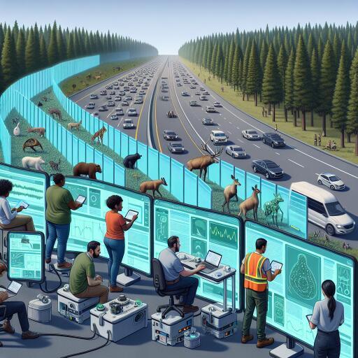
How the System Works
The approach blends three pillars—sensing, prediction, and timely alerts—into a single safety net:
- Roadside sensor arrays monitor traffic, visibility, and animal movement. Depending on the corridor, that may include thermal or optical cameras, radar, acoustic sensors, and water-level gauges in flood-prone zones.
- AI models trained on local ecology fuse these inputs with weather and traffic data to generate real-time risk scores for specific road segments.
- When risk spikes, drivers receive warnings via dynamic signs, in-vehicle notifications through connected platforms, or navigation apps integrated with the system’s API.
Rather than passively reacting to collisions after they happen, the technology anticipates them. It adapts to seasonal migrations, dusk and dawn movement patterns, and conditions like fog or flooding that push animals onto roadways.
Ecology Meets Infrastructure
The backbone of the project is a tight collaboration between technologists and ecologists. Training data includes habitat features, historical collision records, and known wildlife corridors. With that foundation, the system prioritizes stretches where animals are most likely to cross and where drivers have the least time to react.
Globally, roadside AI pilots have shown that automated detection and timely cues—such as flashing signs or in-dash prompts—can slow vehicles and cut collisions. Open, modular designs are helping agencies and universities adapt the tools to local species, terrain, and climate. In the U.S., that flexibility is crucial: deer-heavy regions, coastal floodplains, and mountain passes each present distinct risks.
Field Trials With Rural Drivers in Mind
Early deployments in North Carolina are zeroing in on rural communities, where long stretches of unlit roads, variable weather, and limited cell coverage compound the hazard. Teams are testing the system on corridors that traverse forests and farmlands, refining algorithms to distinguish wildlife from livestock and to maintain performance in rain, fog, and glare.
Community feedback is central. Local drivers, road crews, and landowners identify hotspots and confirm what the models predict. Performance metrics include reduced crash reports, fewer carcass recoveries, and lower repair and insurance costs. Over time, the data can steer investments in wildlife crossings, fencing, or vegetation management to restore safe connectivity for animals.
Beyond Prevention: Planning, Insurance, and Rail
Rich, real-time risk mapping has ripple effects beyond immediate safety:
- Transportation planning: Agencies can prioritize upgrades where AI flags persistent hazards, aligning engineering with known migration routes.
- Insurance analytics: Insurers can model seasonal risk more precisely, incentivizing safer routes and technologies.
- Rail corridors: Similar detection-and-warning systems are being adapted to reduce wildlife-train collisions, particularly for large mammals.
Embedding ethical safeguards is non-negotiable. Systems are being designed to avoid collecting personally identifiable information, favor on-device processing when possible, and incorporate strict data retention limits. Cybersecurity and fail-safe behavior are central engineering requirements.
Hurdles to Scale
Bringing roadside AI to thousands of miles of roadway will require overcoming several challenges:
- Reliability in extreme conditions, from storms and floods to snow and wildfire smoke.
- Power and connectivity in remote areas, including options like solar and edge computing.
- Lifecycle costs for installation, calibration, and maintenance.
- Interoperability standards so different vendors’ sensors and software work together.
- Equity considerations to ensure rural and underserved communities benefit early, not last.
Governance frameworks are also evolving to balance rapid innovation with transparency, audits, and clear accountability when systems trigger automated warnings or speed-management cues.
What Comes Next
As connected and automated vehicles become more common, wildlife-risk data can feed directly into advanced driver-assistance features, enabling proactive braking or speed modulation. In parallel, infrastructure upgrades—like dedicated wildlife crossings and smarter signage—can be targeted using the same analytics, creating layered protection for both motorists and animals.
If ongoing trials continue to deliver, North Carolina’s model could accelerate a national shift from reactive crash reporting to predictive wildlife safety. The prize is substantial: fewer human injuries and fatalities, healthier wildlife populations, and roads that adapt to the living landscapes around them. With AI acting as an early-warning partner, the pathway to safer, more ecologically attuned mobility is coming into view.


Leave a Reply