

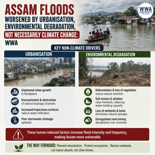
Assam floods worsened by urbanisation, environmental degradation, not necessarily climate change: WWA
A new assessment from the World Weather Attribution (WWA) group concludes that the catastrophic floods that swept through Assam and parts of neighbouring states in 2026 were intensified primarily by local land-use pressures—rapid urban growth, deforestation, wetland loss and riverbank erosion—rather than a clear shift in rainfall driven by human-caused climate change.
Rainfall within historical bounds, impacts amplified on the ground
Researchers examined historical weather records and climate model data and found no robust evidence that the intensity or likelihood of the heavy monsoonal rainfall linked to the disaster had been altered by global warming. The heaviest three-day and 30-day totals were events that typically recur roughly every one to two years in the region, according to the analysis. However, the team cautioned that uncertainties remain due to sparse weather observations and the difficulty of simulating rainfall in complex, hilly terrain.
The floods and landslides killed at least 99 people, displaced hundreds of thousands and inundated about 45,000 hectares of cropland. From late June through early August, upper Assam districts such as Sivasagar, Charaideo and Jorhat—and hill catchments across Nagaland and Arunachal Pradesh—endured sustained monsoonal downpours that triggered widespread inundation and infrastructure damage.
How landscape changes magnified risk
The study highlights how environmental degradation transformed a heavy-rain episode into a multi-dimensional disaster. Key drivers include:
- Rapid urbanisation that paved over natural drainage routes and floodplains
- Deforestation and land degradation reducing infiltration and slope stability
- Wetland destruction that weakened natural water storage and slowed runoff
- Riverbank erosion that narrowed channels and altered flow paths
Collectively, these changes elevated flood peaks and extended the reach of floodwaters downstream, overwhelming communities and farmland.
Limits of hard infrastructure
The analysis raises red flags about relying mostly on concrete-heavy solutions and embankments. While embankments can provide local protection, they also tend to trap sediment, raise riverbeds and impede natural drainage. Over time, this can heighten water levels and the risk of catastrophic breaches. The report underscores the need to avoid locking in designs that shift risk rather than reduce it.
Nature-based solutions and early action
To break the cycle of damage and repair, the researchers recommend a mixed strategy that pairs critical infrastructure with social measures and nature-based approaches. Priority actions include:
- Restoring floodplains to give rivers room to spread safely during high flows
- Conserving and rehabilitating wetlands to buffer peak runoff
- Strengthening anticipatory disaster risk management through localised early warning and early action protocols
- Investing in community-led preparedness, evacuation planning and resilient livelihoods
Unequal burdens and historical legacies
The study traces part of today’s vulnerabilities to historical land allocation and use. Some indigenous and low-income agricultural communities have been pushed onto the most exposed zones—such as riverine sandbars (chars) and marginal banks—where repeated erosion and flooding drive cycles of displacement and loss. Addressing these structural inequities, the report suggests, is essential for durable resilience.
Not every disaster is a climate signal—yet vigilance is vital
WWA’s analysis reinforces a nuanced message: destructive outcomes do not always stem from climate-driven changes in hazard. In this case, the rainfall appears consistent with past variability, while the scale of damage reflects human alteration of the landscape and patterns of exposure. At the same time, the researchers warn that a warming world is expected to continue reshaping monsoon behaviour across South Asia, making proactive land and river management even more urgent.
Closing the data gap
Uncertainties in the findings are linked to limited long-term observations and the challenge of modelling rainfall in mountainous and hilly catchments. Expanding ground-based monitoring, integrating satellite and radar data, and improving high-resolution modelling would sharpen future attribution studies and support local decision-making.
The path forward
The Assam floods of 2026 offer a stark lesson: when development sidelines ecosystems and settles people in harm’s way, even routine extremes can become devastating. Building resilience will require aligning urban planning with hydrology, protecting and reviving natural buffers, and ensuring that the most exposed communities have the resources to prepare, act early and recover. Whether or not climate change drove the rainfall, the region’s future safety hinges on how land is managed—and how risks are shared—today.



Leave a Reply