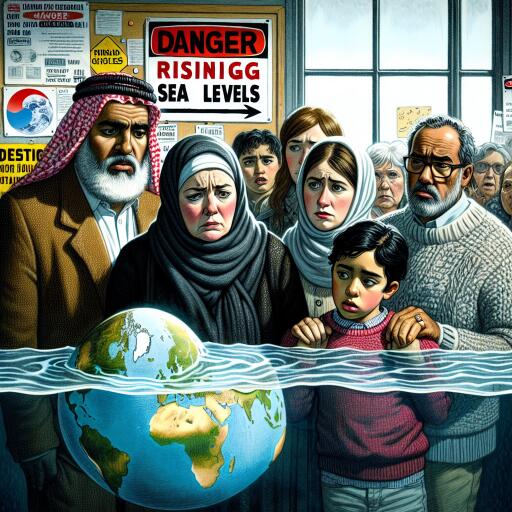
Editorial | Take heed to rising sea levels
Jamaica’s coastline is more vulnerable to the encroaching ocean than many decision-makers have assumed. New scientific work shows that the world has likely underestimated how quickly and how far seas are rising relative to land, sharpening the urgency for the island to rethink its coastal risk and adaptation plans.
Recent analyses using high-resolution coastal data indicate that earlier global assessments leaned on oversimplified models that smooth out local realities such as tides, currents, temperature, and coastal subsidence. The upshot: sea-level baselines were set too low for many shorelines. When the reference frame is corrected, projections shift. By mid-century, the planet appears to be committed to roughly 15 centimeters (about six inches) of additional global sea-level rise, and the extent of land exposed to flooding under higher-end scenarios expands markedly.
These recalibrations matter. If seas were to climb by about one metre, the area projected to be inundated worldwide could be more than a third greater than previously assumed, placing up to 132 million people at increased risk. The greatest discrepancies show up across the Global South—particularly low-lying deltas and coastal plains in Southeast Asia and the Pacific—while parts of Europe and the North Atlantic coastlines show smaller differences. In some hotspots, the mismatch between old and updated estimates can reach a metre and a half.
This is not an abstract concern for Jamaica. In recent years, extreme weather has collided with elevated seas to produce destructive storm surges. A powerful hurricane last October, accompanied by surges topping several metres in places, overwhelmed sections of the western coastline, shredded infrastructure, and halted commerce—an unsettling glimpse of what higher baselines make more likely even in less severe storms. With higher seas, the same wind fields can push water farther inland, amplifying impacts on homes, roads, ports, and tourism assets.
Local evidence underscores the trend. Over roughly six decades, several stretches of Jamaica’s coast have seen beaches retreat by 100 metres or more. As sea levels rise faster than expected, nearshore ecosystems—mangroves, seagrass beds, wetlands, and low-lying coastal forests—face mounting stress. Beach narrowing and erosion accelerate. Saltwater intrusion creeps farther into aquifers and floodplains, jeopardizing freshwater supplies and agriculture. The knock-on effects are ecological and economic: fisheries lose nursery habitats, storm buffers thin, and livelihoods tied to healthy coasts grow more precarious.
What must change now
First, risk baselines must be updated. Planning that relies on outdated elevation or mean sea-level references is planning to be surprised. National and parish-level coastal impact assessments should be recalculated with harmonized datasets that align land elevation and sea-level measurements in a common reference frame, accounting for tides, seasonal variability, ocean warming, and land movement. Where uncertainty remains, adopt conservative design margins.
Second, adaptation financing needs to scale and shift toward nature-positive solutions. Grey infrastructure—seawalls, revetments, raised roads—will be necessary in some corridors, but it is costly to build and maintain and can displace risk. Natural and hybrid systems often deliver better value over time. Priorities include:
- Restoring and expanding mangrove belts, wetlands, and coral and seagrass habitats that reduce wave energy, trap sediments, and stabilize shorelines.
- Replenishing and managing beaches where feasible, paired with dune rehabilitation and setbacks.
- Upgrading drainage and elevating critical assets in zones that cannot relocate, with evacuation routes planned for higher surge heights.
- Protecting and restoring upland forests to slow runoff and reduce sediment loads that smother reefs.
Third, development controls must match the new reality. Zoning that permits intense construction in high-exposure areas invites future losses. Enforce coastal setbacks, halt the removal of natural buffers, and require climate-risk screening for major projects. Where relocation is the safer, cheaper long-term option, begin community-led planning early, with transparent compensation and livelihood support.
Fourth, invest in monitoring and open data. Tide gauges, shoreline change surveys, groundwater salinity tracking, and habitat condition assessments should feed routinely into public dashboards and planning tools. Better observations shorten the feedback loop between science and policy and allow course corrections as conditions evolve.
The cost of delay is rising
The most sobering message in the updated sea-level science is not just that earlier maps were off, but that the cushion for hesitation has thinned. When the baseline is higher than assumed, timelines for overtopping, nuisance flooding, and storm-surge reach move forward. Choices that once seemed deferrable—where to fortify, where to retrofit, where to retreat—demand more immediate answers.
There is, however, a pragmatic upside: clearer sightlines for targeting adaptation. With improved reference frames and local measurements, planners can identify which neighborhoods, wetlands, roads, and water systems face the steepest risk and sequence investments accordingly. That precision matters in a resource-constrained context, ensuring every dollar stretches further and builds resilience rather than a false sense of security.
Jamaica cannot control global emissions trajectories on its own, but it can control how faithfully it reads the shoreline and how decisively it acts on that knowledge. The signal emerging from the latest science is unmistakable: raise the floor of our assumptions, and then raise our ambitions to match. The ocean is coming, slowly but inexorably. The difference between a crisis and a managed transition will be measured in the decisions we make now—about where we build, what we restore, and how we protect the people and places that define the coast.


Leave a Reply