Soil Erosion Risk and Nutrient Loads in Trabzon Watershed
In the ever-evolving realm of environmental science, comprehending the complexities of soil erosion and its extensive ecological effects remains a critical endeavor. A recent study has offered an innovative evaluation of the soil erosion risks within Turkey’s Sogutlu Stream Watershed in Trabzon. By leveraging sophisticated modeling alongside geographic information system (GIS) technology, this research meticulously charts the spatial variability of erosion while analyzing the accompanying loads of organic carbon and total nitrogen present in suspended sediments. The study not only enhances our understanding of erosion dynamics but also connects soil degradation to nutrient cycling, watershed health, and sustainable land management practices.
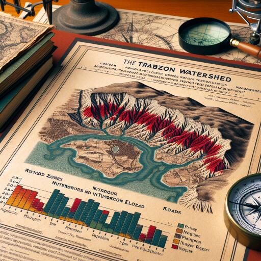
Globally recognized as a major driver of land degradation, soil erosion poses significant challenges to food security, natural habitats, and water quality. Situated in northeastern Turkey, the Sogutlu Stream Watershed is characterized by its diverse topography and climate, rendering it an ideal natural setting for such an extensive study. The susceptibility of soils to erosion in this region is dictated by factors such as slope gradients, land-use patterns, vegetation cover, and rainfall intensity. Fundamental to their assessment is the Revised Universal Soil Loss Equation (RUSLE), a computational model that quantifies potential soil loss by integrating these vital environmental variables.
RUSLE serves as an essential tool for assessing erosion risks by compiling complex data inputs like rainfall erosivity, soil erodibility, topographic factors, crop management, and conservation efforts into a comprehensive prediction model. The integration of RUSLE with GIS reflects a methodological leap; GIS facilitates the analysis and visualization of extensive, varied spatial data, allowing for a detailed examination of erosion risks across the watershed. This confluence of technologies enables researchers and stakeholders to accurately identify severe erosion areas, prompting targeted soil conservation measures.
Beyond estimating soil loss, the study assesses the chemical makeup of sediments displaced by erosion, with a focus on organic carbon and total nitrogen within suspended sediment loads. These components are pivotal in influencing watershed biogeochemistry and downstream ecosystems. The movement of organic carbon and nitrogen with eroded sediments contributes to nutrient enrichment in water bodies, often sparking eutrophication and disrupting ecological stability. Thus, understanding these nutrient transfers is key for crafting integrated watershed management strategies that synchronize soil conservation with water quality enhancement.
Results from the Sogutlu watershed indicate varying erosion rates dispersed across different areas, peaking on steep slopes and regions with minimal vegetation. This variability calls for location-specific conservation initiatives rather than uniform land management policies. The study emphasizes how practices such as agriculture and deforestation heighten erosion risks and nutrient displacement. These findings underscore the importance of adopting sustainable agricultural methods and reforestation efforts to stabilize soils and mitigate adverse environmental effects.
Significantly, the research establishes direct correlations between the geographic distribution of erosion risk factors and patterns of organic carbon and nitrogen loading in the watershed’s sediment flow. Areas with increased erosion coincide with higher suspended sediment concentrations enriched with these nutrients, demonstrating a feedback loop between land degradation and nutrient transport. This relationship highlights soil erosion as a key factor not only in terrestrial degradation but also in aquatic ecosystem changes, with broader impacts on biodiversity, fisheries, and public health.
The study employs a mix of remote sensing data, digital elevation models, and soil sampling to support the robustness of the erosion risk maps. Remote sensing provides timely land cover and rainfall data, while digital elevation models account for topographic variations crucial for erosion modeling. Soil sampling validates the model predictions and aids in analyzing sediment composition. Together, these methodologies exemplify an interdisciplinary approach utilizing modern technological advancements to tackle complex environmental challenges.
The analysis also considers temporal factors, recognizing that erosion and nutrient transport dynamics fluctuate seasonally in response to climate variability. Intense rainfall periods characteristic of the region amplify surface runoff and soil detachment, escalating erosion and sediment-associated nutrient loads. Incorporating the temporal dimension enhances predictive accuracy and aids in planning timely interventions correlated with seasonal risk variations.
Regarding environmental policy implications, the study advocates for the incorporation of GIS-based erosion risk assessments within local and regional land management frameworks. Pinpointing priority zones for erosion control measures enhances resource optimization and regulatory effectiveness. Additionally, considering nutrient loading data supports aligning soil conservation efforts with aims to reduce aquatic system pollution, advancing holistic watershed stewardship.
The study also addresses the broader climate change context, noting that altered precipitation patterns and extreme weather events could aggravate erosion processes in vulnerable watersheds such as Sogutlu Stream. Anticipating these effects through predictive modeling equips policymakers and conservationists with proactive strategies to bolster landscape resilience. Implementing adaptive land management practices informed by spatial and chemical erosion assessments will be pivotal in mitigating future environmental risks amid a changing climate.
The insights garnered from this research extend beyond its immediate geographical scope, serving as a blueprint for erosion and nutrient flux evaluations in similar temperate regions worldwide. The fusion of RUSLE, GIS technology, and sediment chemistry analysis signals an integrated scientific pathway for addressing soil degradation challenges. This work exemplifies the potential of combining traditional environmental science with innovative computational tools to deepen understanding and foster sustainable natural resource management.
Moreover, GIS’s visualization capabilities enable the clear communication of complex erosion risk data to various stakeholders, from farmers to regional planners. Visualization transforms scientific findings into actionable insights, empowering frontline actors to implement conservation practices tailored to site-specific conditions. Such participatory approaches enhance community engagement and ensure the long-term sustainability of soil and water resource initiatives.
The research’s focus on organic carbon and nitrogen mobilization also intersects with global carbon and nitrogen cycles. Soil erosion-induced transport of these elements signifies a terrestrial source of greenhouse gases and nutrient pollution. By quantifying these fluxes, the study contributes to a broader understanding of how land management affects biogeochemical cycles and climate regulation. This intersection of geomorphology, chemistry, and ecology signifies the complexity of environmental challenges that necessitate integrated scientific strategies.
This trailblazing study of analyzing soil erosion risk using advanced RUSLE-GIS modeling, along with nutrient loading examination, offers profound insights with significant environmental and societal impacts. The outcomes establish an indispensable scientific platform for focused soil conservation and watershed management strategies, safeguarding ecosystem services, agricultural productivity, and water quality in the Sogutlu Stream Watershed and similar terrains worldwide. This research is a crucial advancement in comprehensive environmental risk assessment and landscape sustainability science.


Leave a Reply