

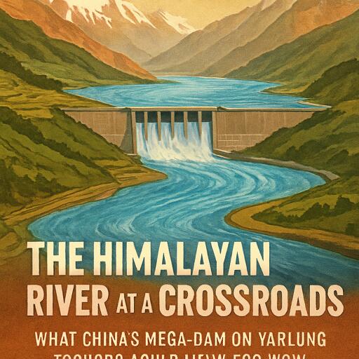
The Himalayan River at a Crossroads: What China’s Mega-Dam on Yarlung Tsangpo Could Mean for India
In the high eastern Himalayas, a river begins as the Yarlung Tsangpo, cutting across the Tibetan Plateau before plunging around a dramatic curve known as the Great Bend. From there it enters India as the Siang in Arunachal Pradesh, later joining other major tributaries to become the Brahmaputra, a river system that supports vast ecosystems, farms, fisheries and cities before continuing into Bangladesh.
That shared river basin is now at the heart of a growing debate. China is pursuing a giant hydropower project near the Great Bend, a scheme that could rank among the largest dam developments ever attempted. For Beijing, the plan fits into a broader push for low-carbon electricity and energy security. For India, however, the bigger issue is what a structure of this scale could do to a fragile mountain river long before it reaches the plains.
The core concern is not simply whether less water would flow downstream. River systems are shaped by timing, sediment, seasonal pulses, flood cycles and ecological links. A major dam can alter when water is stored and released, how much silt continues downstream, and how surrounding landscapes respond during intense rainfall or seismic activity. In a basin already stressed by climate change and extreme weather, those changes matter.
A River Shared by Three Countries
The Yarlung Tsangpo-Brahmaputra is a transboundary river, meaning decisions in the upper reaches can affect people far downstream. China controls the headwaters; India receives the river in Arunachal Pradesh and Assam; Bangladesh depends on the lower basin. That geography makes upstream engineering a regional issue, not a local one.
For downstream communities, the timing of river flow is often as important as volume. If water is held back during one season and released in another, farming cycles, flood patterns and riverbank stability can all shift. This is especially important in the Brahmaputra basin, where monsoon rains, glacier melt and steep topography already create a highly variable river regime.
Why the Great Bend Is So Sensitive
The proposed project site lies in one of the most striking landscapes in Asia. At the Great Bend, the river swings sharply and drops through a deep gorge, creating enormous hydropower potential. But the same steep gradients that make the location attractive for electricity also increase environmental and geological risk.
The eastern Himalayas are young mountains in geological terms, and they remain highly dynamic. Slopes are unstable, erosion is intense and landslides are common. Rivers here do not move through fixed channels for long; they carve, shift and rebuild the terrain continuously. Building mega-infrastructure in such a setting demands more than engineering confidence. It requires long-term understanding of how a dam would interact with a living mountain system.
What It Could Mean for Arunachal Pradesh
Arunachal Pradesh is the first Indian state to receive the river. There, the Siang is fast, forceful and loaded with sediment. The region is already vulnerable to flash floods, heavy erosion and slope failures, especially during the monsoon. At the same time, it is also seen as one of India’s key hydropower frontiers, with multiple large projects proposed or under discussion.
This creates a layered challenge. If both upstream and downstream sections of the same river are increasingly modified by dams, the cumulative effects could become difficult to predict. One project may change flow timing; another may alter sediment passage; together they may reshape habitats, riverbanks and flood behavior across the basin.
The Seismic Question
Any conversation about a mega-dam in the Himalayas must also consider the ground beneath it. The mountains exist because the Indian and Eurasian tectonic plates are still colliding, making the region one of the most earthquake-prone on Earth. Large reservoirs in such zones raise difficult questions about slope stability, rock fractures and long-term safety.
Scientists often point to the possibility of reservoir-induced seismicity, a phenomenon in which the weight of stored water and the movement of water into rock fractures can influence underground stress. This does not mean every dam triggers damaging earthquakes. But in an already active seismic belt, the risk cannot be dismissed. Continuous monitoring, transparent data and rigorous geological study are essential.
The Hidden Importance of Sediment
Public debate around dams usually focuses on water, yet sediment may prove just as important. The Brahmaputra is one of the world’s great sediment-carrying rivers, transporting huge loads of sand, silt and rock fragments from the Himalayas. That sediment helps build floodplains, nourish farmland and shape river channels downstream.
A large dam can trap much of that material behind its reservoir. Over time, that may reduce reservoir efficiency upstream while depriving downstream stretches of the sediment they naturally receive. In Assam, where channel migration and bank erosion already displace communities, any major change in sediment supply could alter how the river behaves over decades.
Assam’s High Stakes
Once the river reaches Assam, it widens into one of India’s most important valley systems. The Brahmaputra underpins agriculture, fisheries, transport, wetlands and livelihoods across the state. It is also tied to recurring disasters: seasonal floods damage settlements and crops, while erosion steadily eats away at villages and farmland.
That means upstream changes must be viewed in the context of existing vulnerability. If dam operations influence flood peaks, dry-season flows or sediment transfer, the effects may ripple through local economies and ecosystems. Even small changes can become significant in a basin where millions of people depend on the river’s natural rhythm.
Climate Change Complicates Everything
The debate comes at a time when Himalayan rivers are already changing. Rainfall patterns are becoming less predictable, extreme precipitation events are intensifying and warming temperatures are affecting snow and glacier dynamics. As a result, future flow patterns may no longer resemble the historical conditions used to design large infrastructure.
That raises a difficult planning question: can a project built for yesterday’s hydrology remain safe and effective in tomorrow’s climate? In the Himalayas, climate risks are closely tied to landslides, glacial inputs, sediment surges and flood extremes. A mega-dam in such a basin must be assessed against a moving environmental baseline.
The Need for Cooperation
For India, the response cannot rest on rhetoric alone. Stronger river monitoring, better sediment tracking, improved flood forecasting and real-time warning systems are all crucial. Scientific data-sharing among countries in the basin would also be invaluable during extreme rainfall, earthquakes or sudden changes in river flow.
Ultimately, this is not just a story about one dam. It is about how three countries manage a connected river in an era of rising energy demand, geopolitical mistrust and climate instability. The Yarlung Tsangpo-Siang-Brahmaputra is more than a source of hydropower. It is a complex ecological artery. What happens upstream could shape the future of northeastern India for generations.



Leave a Reply